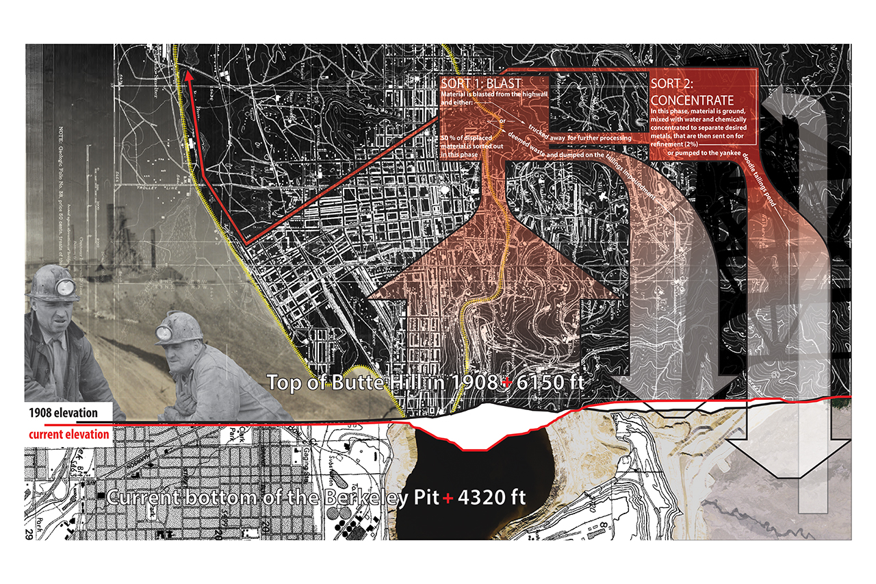
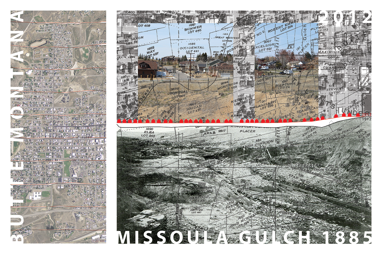
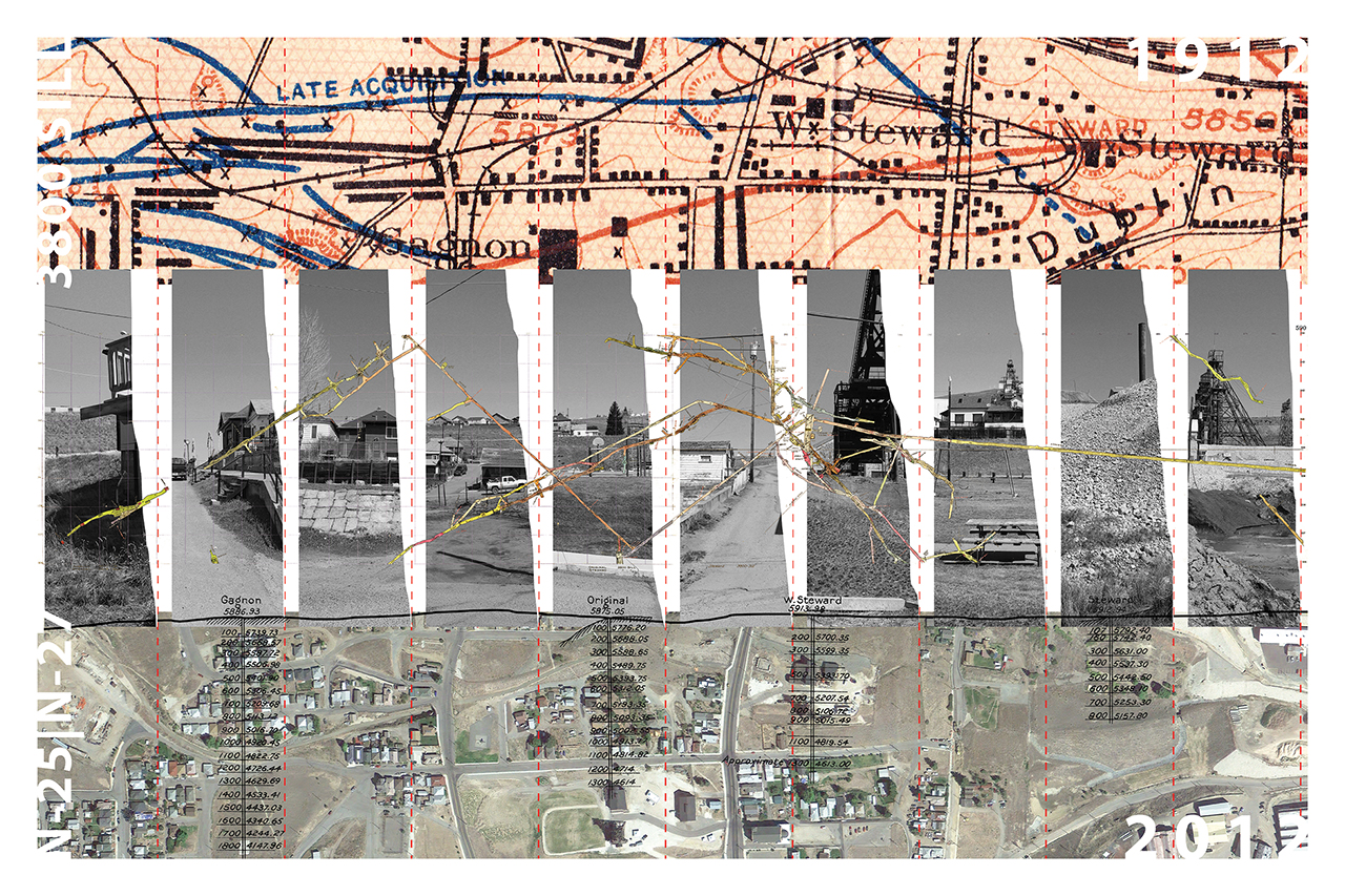
Butte, Montana has been mapped for the last 150 above and below ground for purposes extraction. Both the traditional surface maps of the City of Butte (Sanborn, Property and Topographic maps) and the Stope Books (detailed accounts of the underground workings) are an incredibly detailed account of the growth and shape of Butte above and below ground. These maps pursue a clear agenda of value. However, there is little documentation of the massive amounts of waste rock replaced back onto the city -- rock that has profoundly shaped this urban landscape -- once the precious metals were displaced for use around the world.
These maps contribute to the discourse creating new readings / realities of Butte. Unlike the historic recordings both above and below the ground of the region, these new maps have a specific focus on the condition of the displaced / replaced landscape, thus producing a new understanding of place. This new understanding generates an alternative dialogue of value in order to move beyond the myopic tracing of extraction. These maps aim to create a new discourse around the possible futures of this place; futures that are possible in part to a new understanding of this “given” landscape. The maps become instruments that both document and project simultaneously. They reveal a landscape that is no longer an unknown byproduct of industrialized sorting, but one that is a newly understood topography of possible occupation and intervention.
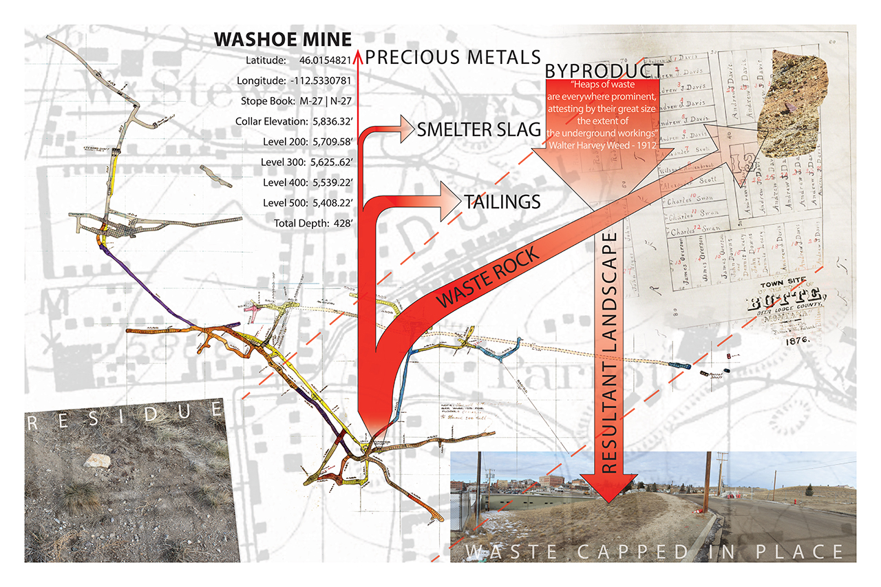
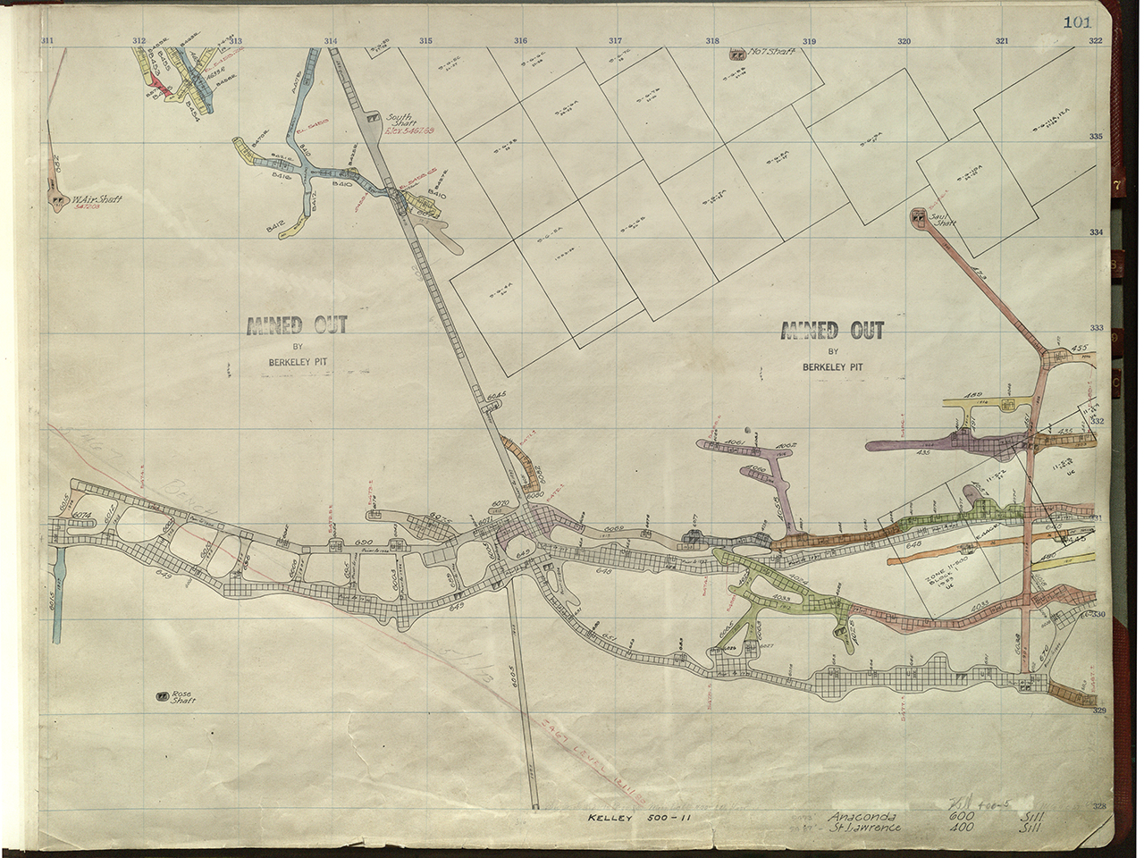
Sheet 101 right from the M 29 volume 2 Stope Book created by the Anaconda Mining Company